Ohinemuri Regional History Journal 43, September 1999

Re-produced above is a 1935 docket for stock sold by W Manning to J Walls, butcher of Paeroa.
Early Meat Sales
Ohinemuri Regional History Journal 43, September 1999

Waitawheta Gorge. Typical of the difficulty of access to the workings. Tramway to Woodstock Shaft and Crown Mine on left.
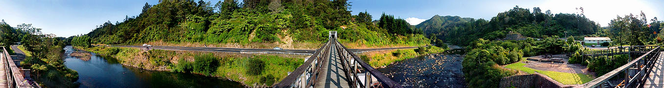
Talisman Mine - Karangahake
Ohinemuri Regional History Journal 43, September 1999

Albert Reed's Home - Battery Flat, Karangahake - 1898.
Albert Reed's Residence Site License
Ohinemuri Regional History Journal 43, September 1999
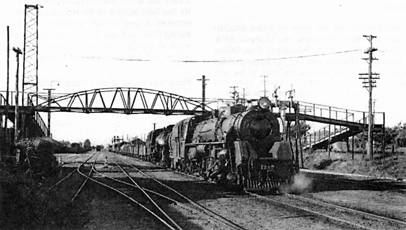
Looking north, the bridge as originally built. The bow stringers of the 50-foot truss were of 70lb double headed iron rail which had come from Canterbury where, years earlier, it had been used on the Great Northern Railway of Canterbury 5 foot 3 inch gauge line. The truss was similar in construction to other foot bridges.
Hill Street Railway Crossing
Ohinemuri Regional History Journal 43, September 1999
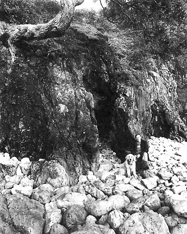
Entrance to the main adit at Oukori Bay, July 1996. The adit, which extends for about 110 metres along an east-west trending quartz vein, was probably opened up between 1894 and 1902. Photo: Lloyd Homer.
Sinking on the Treasure Island Reef
Ohinemuri Regional History Journal 43, September 1999
Waitawheta Gorge. Entrance to Woodstock shaft. Boiler House supplied steam for the pump in the Woodstock shaft. (1913)
Talisman Mine - Karangahake
Ohinemuri Regional History Journal 43, September 1999

Looking from the Hill Street side after the bow string truss had been replaced with a girder span. Note the ramped approaches on both sides.
Hill Street Railway Crossing
Ohinemuri Regional History Journal 43, September 1999

Jonathan Brown's sketch map, drawn in or prior to 1870, showing the area of his party's applied-for prospecting claim. This area, which measured about 6 x 7 miles, possibly included the site of present day Waihi and Martha (Pukewa) Hill. Had Brown and his associates explored that far inland (and perhaps noted the existence of quartz reefs there), or simply drawn an arbitrary line as their boundary? This may be one of the oldest surviving maps of the Ohinemuri district. Reproduced with permission, National Archives, Wellington (AP 2, 1764/73).
Discovery of Gold at Waihi Beach
Ohinemuri Regional History Journal 43, September 1999

Copy of the "License For A Residence-Site" issued to Albert Reed on 9 March 1897.
Albert Reed's Residence Site License
Ohinemuri Regional History Journal 43, September 1999
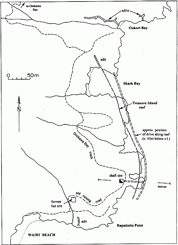
Location of mining related features, and the Treasure Island Reef, on the headland north of Waihi Beach.
Sinking on the Treasure Island Reef
Ohinemuri Regional History Journal 43, September 1999
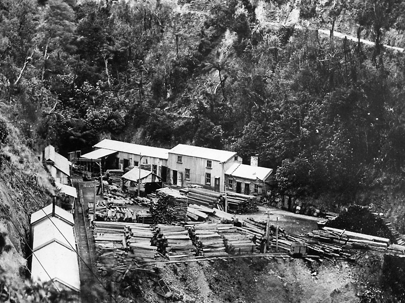
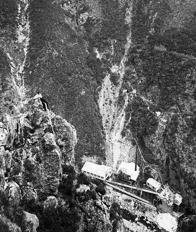
No. 8 Level Talisman Mine. Buildings include blacksmith's and carpenter's workshops and change and cook houses. The timber will be used underground. Tramway on left to aerial ropeway. Road access from Mt Road on the right. (1913)
Talisman Mine - Karangahake
Ohinemuri Regional History Journal 43, September 1999

An incidental view of the northern headland at Waihi Beach, circa 1905-10, showing the Waihi Beach Goldmining Company's shaft headframe and associated powerhouse with its twin chimney stacks. The nearby hut (directly above the figures) may have served as a blacksmith's workshop and assay house.
Sinking on the Treasure Island Reef
Ohinemuri Regional History Journal 43, September 1999
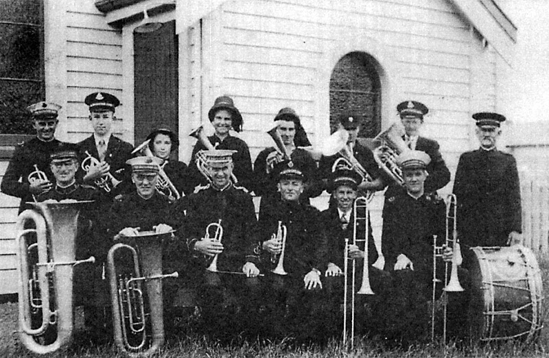
PAEROA SALVATION ARMY BAND (circ. 1938).
Back Row: Lou Callagher - Marcel Morrell - Jean Callagher - Hazel Brock - Marjory Caddy - Bernie Callagher - Laurie Hill - Charles Malcolm.
Front Row: Tom McKenzie - Ernie Martin - Bert Lindsay - Selwyn Smith - John Hill - Jim Brock.
Brass Bands of Paeroa
Ohinemuri Regional History Journal 43, September 1999

Rev. W H Wilson
A Century of Anglican Clergy in Paeroa
Ohinemuri Regional History Journal 43, September 1999
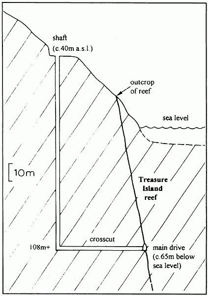
Section through the main shaft and crosscut of the Mine.
Sinking on the Treasure Island Reef
Ohinemuri Regional History Journal 43, September 1999
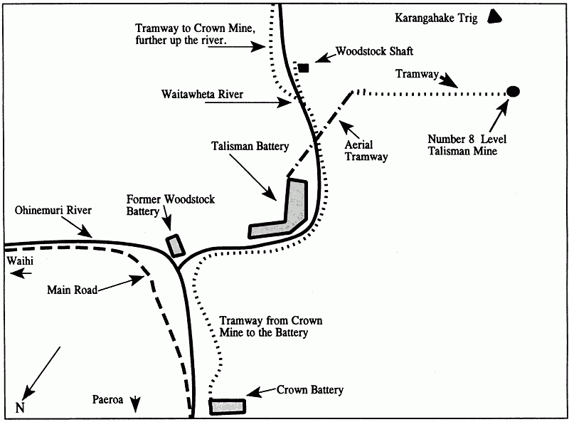
A sketch plan of the Karangahake area showing the features mentioned in the article. (not to scale)
Talisman Mine - Karangahake
Ohinemuri Regional History Journal 43, September 1999

General view of the area of the Karangahake Mt. that was mined by the Talisman Coy. Talisman battery and the power houses are shown. The top of the aerial ropeway is in the upper centre at the level of the No. 8 Level. Photo 1909.
Talisman Mine - Karangahake
Ohinemuri Regional History Journal 43, September 1999

The 560 HP steam engine which drove most of the Battery machinery. The concrete foundation, driving arms and wheel shaft can be seen at the present time. Photo 1909.
Talisman Mine - Karangahake
Ohinemuri Regional History Journal 43, September 1999

Woodstock Shaft chamber, late 1960s. Note the remains of the pump. The person in the centre, background gives an idea of the scale.
Talisman Mine - Karangahake
Ohinemuri Regional History Journal 43, September 1999
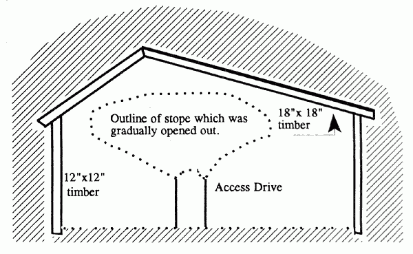
Section of Woodstock Pump Chamber, showing method of excavation. The timbers would not have been in position at the stage of excavation shown.