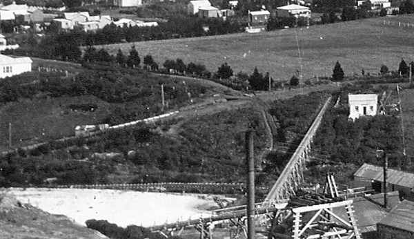
The prominent ditch on the side of Pylon Paddock, running from the gate up towards Baker Street may be a "by-wash" for the Cassel (then Waihi Gold Mining Co.) water race. When water from the race could not be used by the Pelton wheels or turbines it had to be released (ie. into a by-wash). This ditch could have taken the water down into the valley, away from the middle tailings pond.
After the Cassel plant no longer needed the water race the Waihi Gold Mining Co. took it over, fluming the water across the valley to the Waihi Battery. The logical place for a by-wash would be just before the water entered the flume (near end of Baker Street), and where it could flow away doing least damage. Both the c.1906 photograph and the 1909-10 panorama show what appears to be the flumed upper section of this by-wash. The 1906 photograph shows two small bridges crossing this by-wash at the end of Baker Street.
By the way, neither of these photographs show any pine trees in the Mill Stream area except at Speak’s Quarry. Small pine trees can be seen on Union Hill.
The drain from the gate to just downstream of the upper bridge (behind Charlie’s seat at Cabbage Tree Flat) appears to be a continuation of the by-wash (the drain predates the by-wash, see Drain west of Charlie’s Seat). An early map portrays Mill Stream in a continuous line as the Cassel race, the by-wash, the drain and current alignment to Clarke Street. The drain is visible in the 1942 aerial photograph.

Mill Stream Walkway Heritage Features.
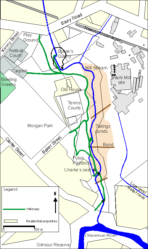
Map showing walkway, present stream alignment, Speak’s Quarry, old tailings ponds and the Waihi Battery site. By-wash is shown on mouse over.

