Ohinemuri Regional History Journal 50, September 2006
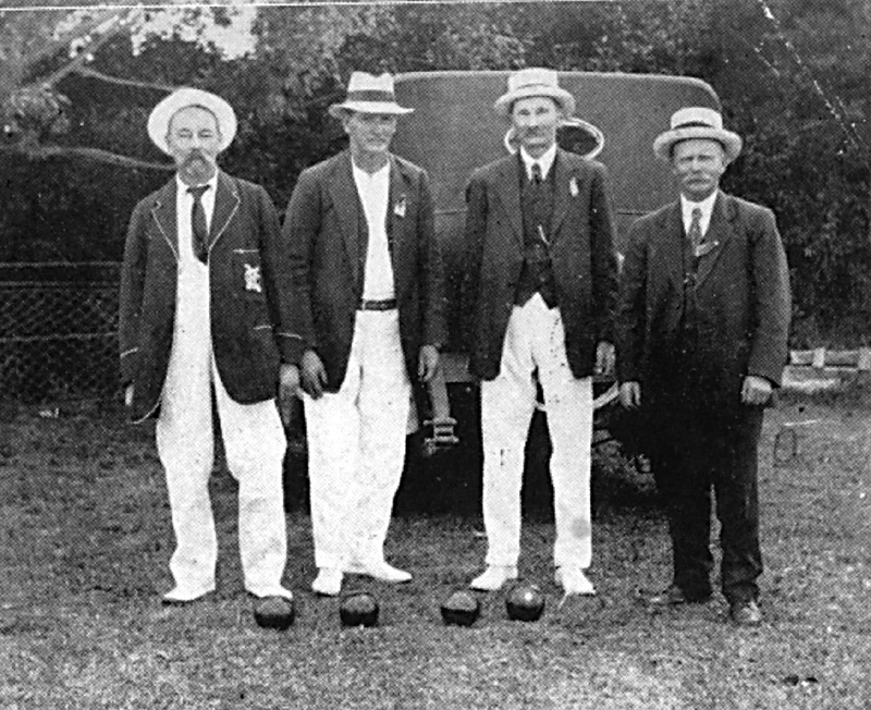
Opening of the Alley Memorial Park, Hikutaia, January, 1923. These four men were among the most prominent of the many who played their part in the establishment of this fine sports complex for bowls, tennis and croquet. They are from the left Mr F. Maxwell , Mr J. Elliott, both members of the first committee, Mr W. H. Alley, donor of the land from his adjacent farm and first president, and Mr Hugh Morrison, green superintendent.
Ohinemuri Regional History Journal 50, September 2006
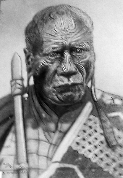
Chief Taraia Ngakuti Te Tumuhia.
An Unique Piece of Hauraki History
Ohinemuri Regional History Journal 50, September 2006
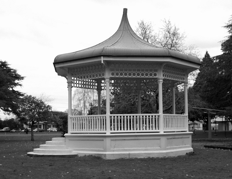
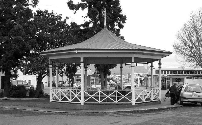
Domain Rotunda.
Paeroa's Band Rotundas
Ohinemuri Regional History Journal 50, September 2006
The Domain Bowling Pavilion, built in 1907 and destroyed by fire in June 1999.
Paeroa Bowling Club Centenary
Ohinemuri Regional History Journal 50, September 2006
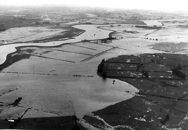
Farmland from Paeroa to Kopu was inundated with flood water.
The Flood of All Floods
Ohinemuri Regional History Journal 50, September 2006
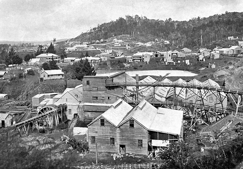
A general view of Waitekauri, c 1900. Showing in the foreground is the 40-stamp mill and cyanide plant of the Waitekauri Gold Mining Company. On the left is the huge waterwheel, the biggest in the North Island and built in the early 1880s, which was the driving power of the complete process.
Inside Front Cover
Ohinemuri Regional History Journal 50, September 2006
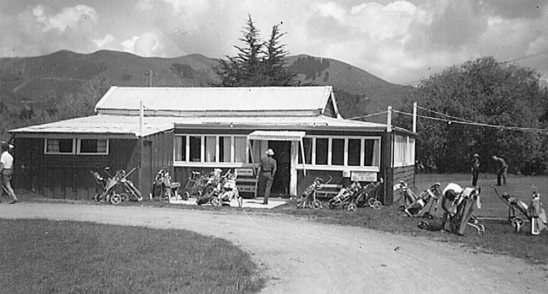
The original Paeroa Golf Clubhouse on its present Rotokohu course.
Proud Record Set By Paeroa Golf Club
Ohinemuri Regional History Journal 50, September 2006
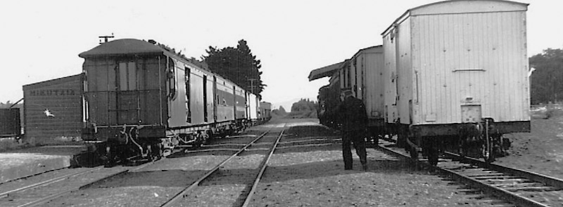
Train Number 338, the 4 p.m. mixed from Thames to Paeroa at Hikutaia. The engine is shunting at the goods shed, the guard supervising the operations. December 22, 1947. (J. W. Sutherland photo).
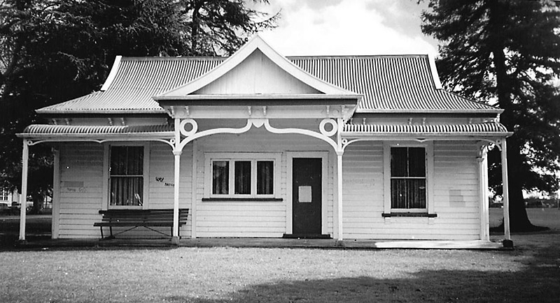
Hikutaia Railway Station
Ohinemuri Regional History Journal 50, September 2006
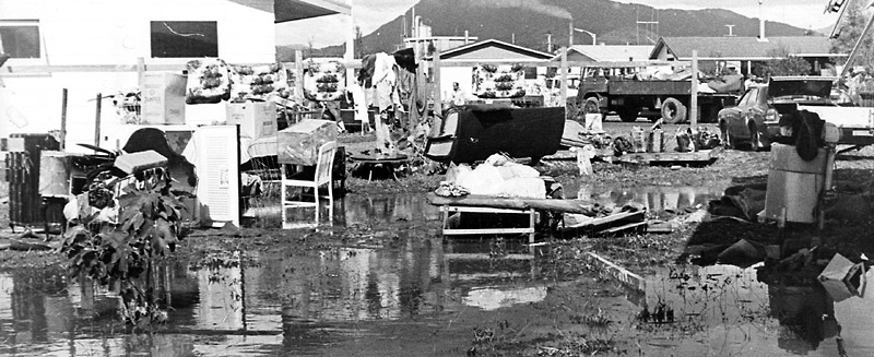
Household effects in Menzies Place waiting tobe collected and taken to the rubbish dump.
The Flood of All Floods
Ohinemuri Regional History Journal 50, September 2006
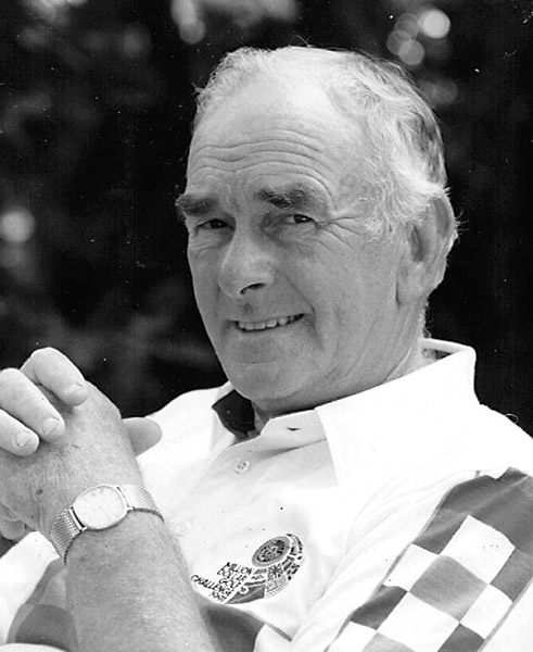
Ian A. Martin.
Obituaries
Ohinemuri Regional History Journal 50, September 2006
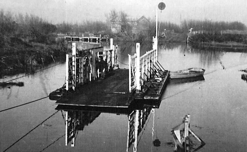
Kaihere ferry.
Memories of the Hauraki Plains Ferries
Ohinemuri Regional History Journal 50, September 2006
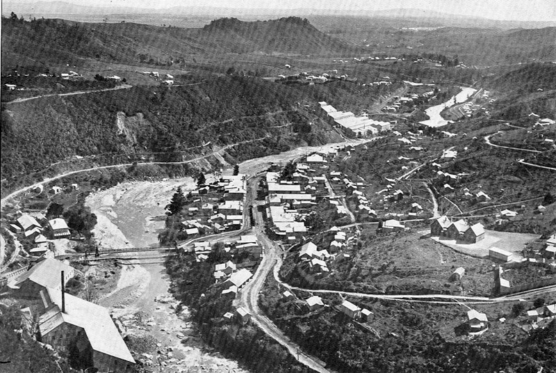
Karangahake at the height of the gold mining, c 1900 [the railway station looks to be recently completed, therefore after 1904 - E].
Ohinemuri Regional History Journal 50, September 2006
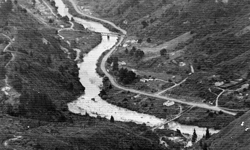
Karangahake, c1946.
Ohinemuri Regional History Journal 50, September 2006
Can any reader assist with the identification of this painting of Karangahake?
Please contact the Editor, 07 862 8486.
Ohinemuri Regional History Journal 50, September 2006
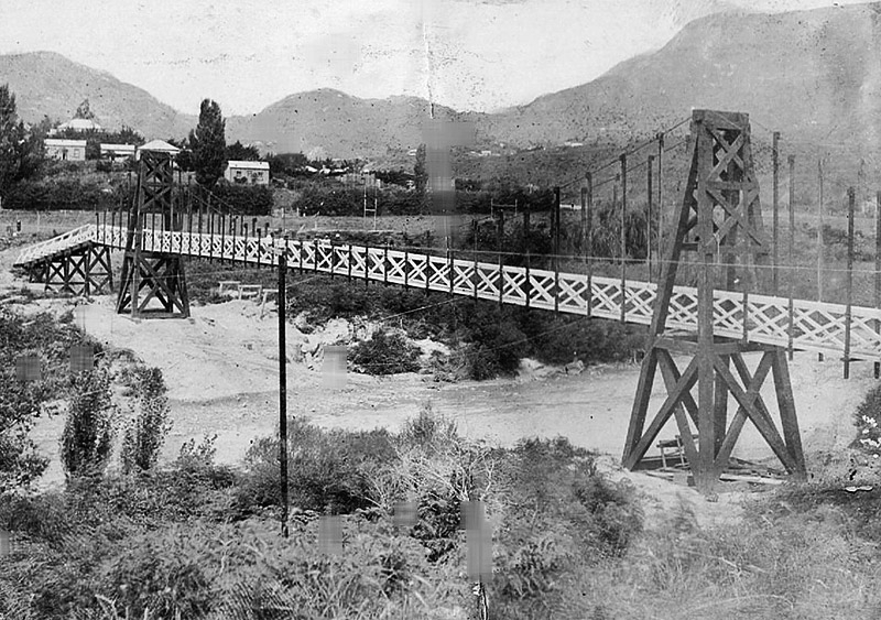
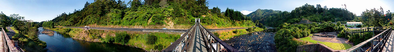
The pedestrian suspension bridge at Mackaytown was erected in 1906 to give access to the "flag station" on the Paeroa-Waihi railway line. In February, 1944, the Ohinemuri County Council was informed that the Public Works Department had no further use for the bridge and the council decided to demolish the structure.
Ohinemuri Regional History Journal 50, September 2006
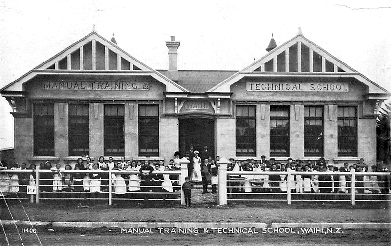
The Waihi Manual and Technical Block, c 1900 [opened 1913 - E]. Now the Waihi Gold Mining Museum.
Inside Back Cover
Ohinemuri Regional History Journal 50, September 2006
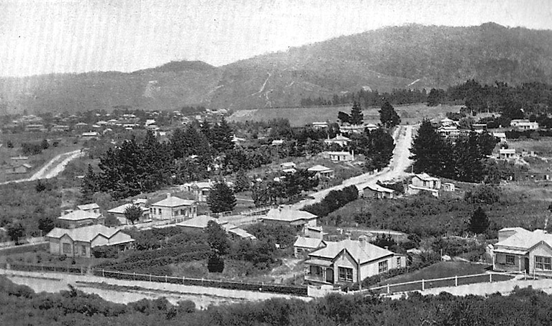
Moresby Avenue and Hollis Bush, Waihi, c 1900.
Ohinemuri Regional History Journal 50, September 2006
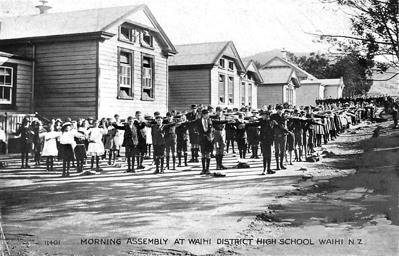
Morning assembly at the Waihi District High School, c 1900.
Inside Back Cover
Ohinemuri Regional History Journal 50, September 2006
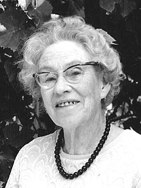
Mrs N. S. Climie, M.B.E.
The First Editorial--1964
Ohinemuri Regional History Journal 50, September 2006
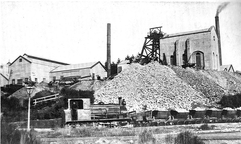
Waihi Gold Mining Company's No. 5 shaft showing the Cornish Pumphouse. This structure is currently being moved to a safer position.
Ohinemuri Regional History Journal 50, September 2006
Paeroa with Opatito Road in the foreground across to Taylor's Avenue.
The Flood of All Floods
Ohinemuri Regional History Journal 50, September 2006
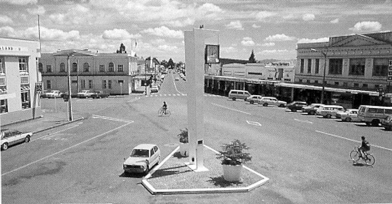
The centre of Paeroa and Belmont Road from the Post Office balcony, c 1976.
Ohinemuri Regional History Journal 50, September 2006
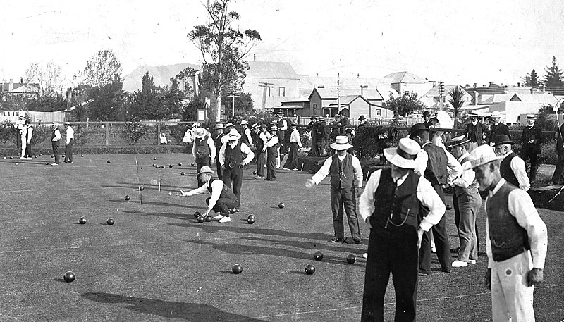
Playing bowls at the Domain, c 1907.
Paeroa Bowling Club Centenary
Ohinemuri Regional History Journal 50, September 2006
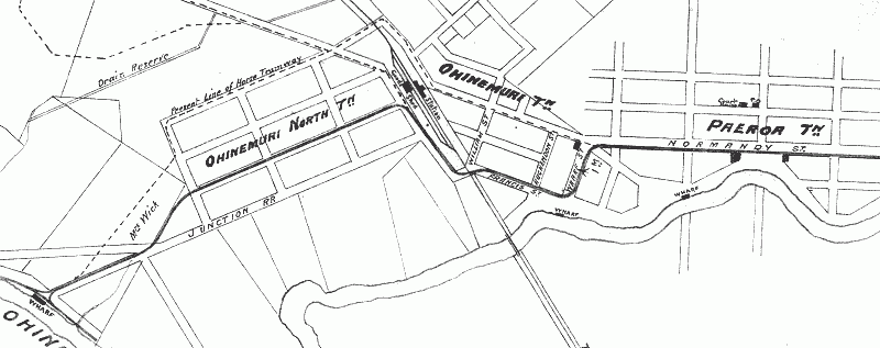
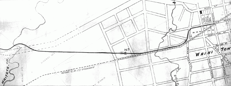
The proposed route through Paeroa from the Junction Wharf (left) towards Waihi.
Paeroa-Waihi Light Rail Link
Ohinemuri Regional History Journal 50, September 2006
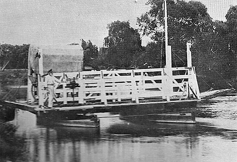
Puke ferry.
Memories of the Hauraki Plains Ferries
Ohinemuri Regional History Journal 50, September 2006
Railway Reserve Rotunda.
Paeroa's Band Rotundas
Ohinemuri Regional History Journal 50, September 2006

Rev. L. M. Rogers, M.A.
President's Foreword--1964
Ohinemuri Regional History Journal 50, September 2006
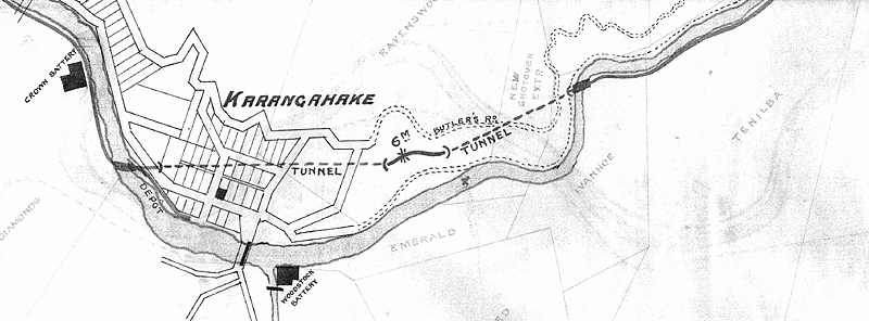
The route under Karangahake township.
Paeroa-Waihi Light Rail Link
Ohinemuri Regional History Journal 50, September 2006
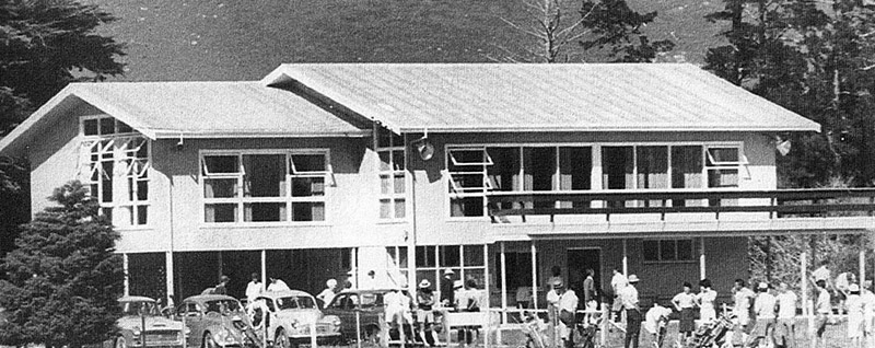
The second new clubhouse which was opened in March, 1969.
Proud Record Set By Paeroa Golf Club
Ohinemuri Regional History Journal 50, September 2006
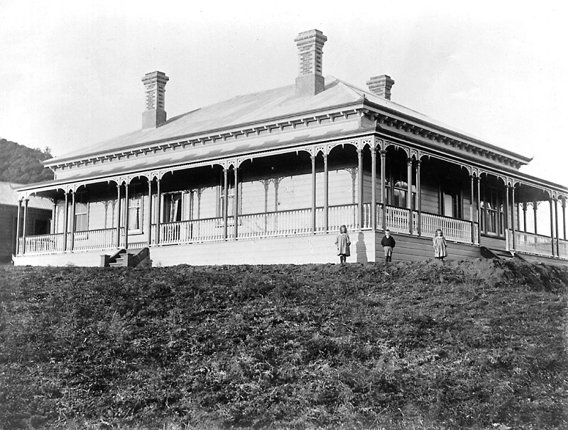
Talisman House, c 1900.
Talisman House
Ohinemuri Regional History Journal 50, September 2006
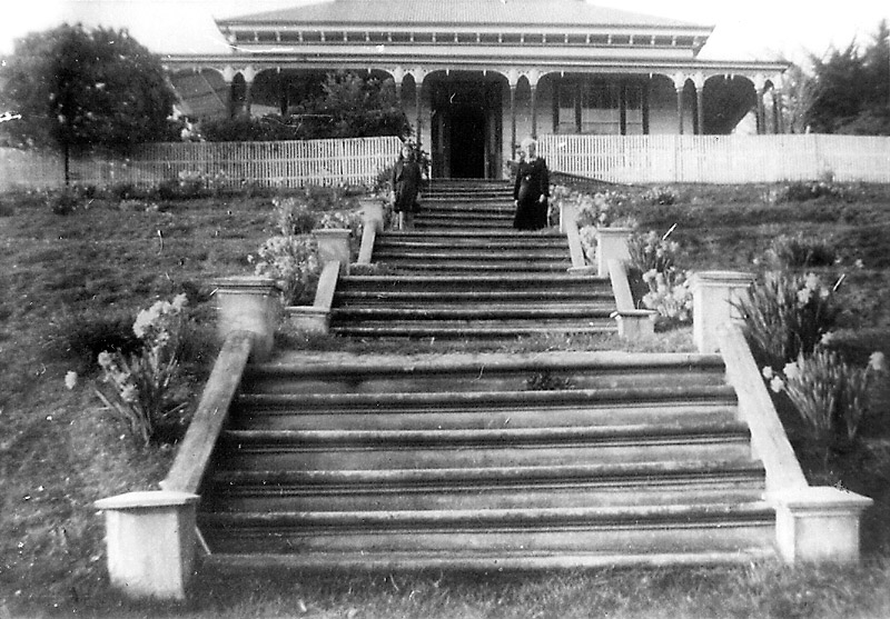
The majestic stair case which connected the Talisman House with the main road.
Talisman House
Ohinemuri Regional History Journal 50, September 2006
The Waihi terminus in Kenny Street-Hasard Street.
Paeroa-Waihi Light Rail Link
Ohinemuri Regional History Journal 50, September 2006
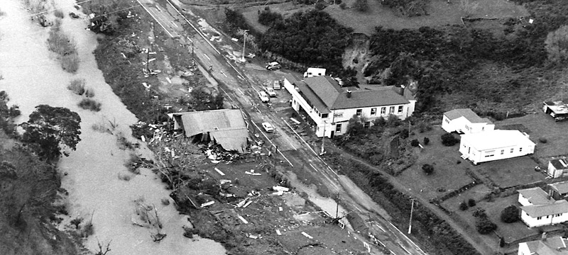
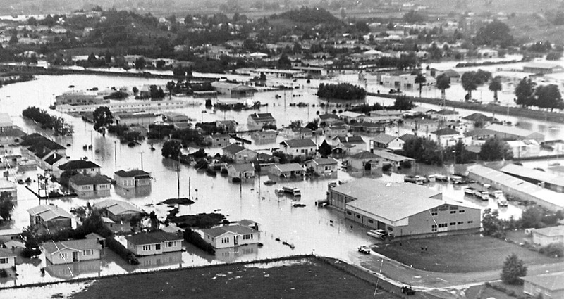
Waikino from the air after the Ohinemuri River swept through the hamlet late on Monday, April 13.
The Flood of All Floods
Ohinemuri Regional History Journal 50, September 2006
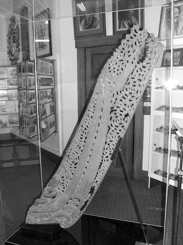
The restored waka taurapa or stern post.